| Caryl and Brian's World Bike Tour |
|
European Tour 2006 IV- Germany, France |
![]()
![]()
![]()
![]()
|
|
EUROPEAN TOUR 2006 PART IV – GERMANY, FRANCE
Branau, AT to Brest, FR August 1 to September 2, 2006 Start 49,780 miles (79,647 km): End 50,562 miles (80,899 km) cumulative
TEASERS
East Germany Donau Radweg
Branau, AT to Neuberg, DE August 1 to August 8
We did start to notice a rather strange trend in German grocery stores. Finding what we would call a normal grocery store, one that has a deli and bakery counter, a full range of vegetables that you select by weight, a full spread meat counter, and rows upon rows of canned goods, is rather difficult. Usually what you only find are discount stores. These are similar to what we call the Grocery Outlet stores in the U.S. They have names like Lidl and Aldi and have a very, very limited selection of extremely discounted items. While a normal store would have an entire refrigerator dedicated to just cheeses, these discount stores may have only 5 or 6 varieties. Most German towns have just these kinds of discount stores, nothing else. It was really weird.
Stores in Austria tend to be of both types, discount and upscale. Switzerland's supermarkets were somewhat similar to those in Austria. Portugal's markets seem to be up and coming. Where they had just built new markets they tended to be very nice, large super stores. Spain's stores were sorely lacking. They were few and small. But, from what we've seen, nothing beats the supermarkets in France. France does have a few of the discount places, but the majority of their markets would put those of the U.S. to shame. Even the smallest store has deli, meat, cheese, produce, and packaged food selections that would make a gourmet salivate. While most super stores in other countries tend to have a ratio of about 40% food to 60% other stuff, the French super stores have more a 60% food, 40% stuff ratio. Just the fresh cut cheese counter alone will fill a single aisle, and that doesn't include the prepackaged cheese aisle. They are amazing.
Now while France has some of the best grocery stores we've seen, it also has some of the worst toilets. It's absolutely astounding that a country that prides itself on being so sophisticated has such awful toilet facilities. First of all you have to find one. Public toilet facilities are rare. Stores don't have them and you won't find any around town. You usually have to resort to finding a McDonald's. Next, in much of France you still find squat toilets. Even brand new facilities have them. In fact, we even found a fiberglass porta-potty that was of the squat variety. These are so much fun. When you flush you have to be prepared to run or else your feet get wet. They seem like something the developing world still uses. Actually the only other places we've seen them was in the developing countries and Asia. The modern world uses sit toilets.
Finally, the cleanliness of a lot of France's toilets leaves a lot to be desired. Campground facilities are usually quite clean, although we came across some were dreadful. Toilets in shopping malls, highway rest areas, and even that porta-potty quite often are absolutely disgusting. Not only can they be filthy, but often they're broken as well. The number of times we searched high and low for the only bathroom around just to find an out-of-order sign. In the shopping center in Briancon the only men's room was out of order, so the men were using the lady's room in which 2 out of 4 toilets were broken and 3 out of 4 sinks stopped. France's toilets leave a lot to be desired.
Back in Austria, where the toilets are almost spotless and in perfect working condition, we rode on down the Inn to arrive in Passau fairly early in the afternoon. This would be the farthest east we'd go for now and represents our connection with our east route going to Budapest. The continuation of that route to the Black Sea would have to wait for another year.
Our plans had been to spend just one night at the very nice little tent only campground just east of town and then head west in the morning. In 1999 we'd seen all the museums, attended the afternoon recital of the world's largest organ, and wandered all around town. We saw no reason to do all this again.
At 7:30 AM the rain all night drizzle let up and brighter skies started to develop. This wasn't to last. By 8 AM rain had returned with a vengeance. It rained and rained and rained virtually nonstop from that 8 AM until the next morning at around 7 AM. For days we'd been experiencing heavy afternoon thundershowers. But this was the first time the rain just fell in a constant, dismal drizzle. Sometimes it would pour hard just to make things interesting. But for the most part it was a bone drenching drip. It was just enough to make riding down right miserable.
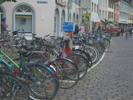
Passau, being a junction of several of the most popular radwegs, bike tourists are coming and going all day long. Even on such a yucky day there were bikers coming and going. However, as we were to discover further upriver, most do not camp. While we kept seeing groups arriving in town during the day, the number of camp groups remained nearly constant, about 5 or 6. It's one thing to ride all day long in the rain, get soaked through and through, and then have to stay in a tent and cook outdoors. It's an entirely different matter if you're staying in a hotel with a warm, dry bed and eating in a restaurant. So while many of the gasthaus bikers carried on, those of us who dared to camp stayed put for the day. Otherwise we all would have been miserable.
Cold fronts seemed to be pushing their way across northern Europe in a way more reminiscent of September weather than August. We'd have a day or two where the rains would come in only the afternoon, just long enough to get everything soaked but not so long that we couldn't duck into shelter for the duration. Then a day would come where we'd have drizzle for most of the day. Staying dry on these days was a tad trickier. All the while the temperatures dropped from the high 80s into the low 50s. It really felt like the kind of weather we expected to have in late September, not August. We'd heard that Germany had a cold wet winter. It was beginning to look like summer would be the same.
Our first night out of Passau we stopped at a small farm style campground. We were the only ones camping for the night. It was right next to the river. The owners ran a camping, gasthaus, restaurant, and farm all in one. You do anything you can to make a living.
We stopped in the town of Straubing early on Saturday afternoon. There were several chores to be done and this particular campground happened to be conveniently located. There was one large market within 250 meters as well as two very large bike shops nearby. These were bike shops that we in the US could only dream about. Both were huge and had an enormous selection of parts and accessories. We were able to find a new rear wheel for Brian's bike, his rim had cracked, brake pads, chains, and a back light to replace the one stolen in France all at not too terrible prices. So we spent the afternoon washing clothes, fixing the bikes, and buying our Sunday supply of food while the rains once again poured down.
Sunday morning we rode through the center of town. Sundays in any German town are absolutely dead quiet. All stores are closed and only one or two cafe is open. It's a good time to get photos of the architecture, but not a good time to see anything happening.
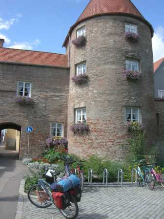
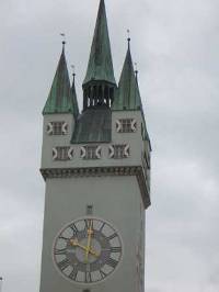
Towns of any size also follow a regular pattern. The main part of town is divided by a wide street which becomes the market place on certain days. Sometimes there are 2 such streets at 90 degree angles. At the ends of the street are town gates with tall towers dating from some ancient century, the 13th to 15th for example. The towers are stucco covered, have several rooms, are topped with a steep gabled roof, and almost always have a very nice set of clocks all precisely accurate. Somewhere along one of these market streets will be the rathaus, appropriately named town hall. Several churches in the Gothic or Baroque style will usually be found scattered around the old town as well. Bavarian towns become almost predictable. It wasn't until we left the Bayern region at Ulm that we saw this pattern change
There are many old Bavarian towns all along the Donau. Since the Donau has always been a main transport corridor, many of these towns show a great deal of prosperity. Today that translates into big tourist attractions. Every town vies for your tourist dollar. Consequently there are well staffed information centers in even the smallest burg. Museums absolutely abound. But without having a descent guide book that describes what is in each museum, we were reluctant to spend a lot of money and time visiting them all. We'd save that for another time. For this trip we'd stick to doing the walking tours which usually were in English.
Passing through the center of Straubing we continued westward along the Donau Radweg. Sometimes we rode up on the dyke. Sometimes we were on the dirt service road at the side. Sometimes we took shortcuts through the corn fields. The river remained rather dark, but not muddy looking and large boats continued to ply its waters. Within one day we made it to the very tourist town of Regensburg. It's touristy partly because it is one of those old Donau villages but also because the large river cruise boats can still come this far and do stop.
The camping was a bit further upriver but still considered to be in town. We pulled in and the man at the desk suggested we first have a look around. Evidently much of the campground had been under water when he arrived in the morning. So he wasn't convinced we could find a dry spot. Fortunately it appeared as though the grounds did drain well enough for us to pitch the tent. Unfortunately this camping proved to be the most expensive one we'd found in 3 1/2 months travel. It wasn't even all that fancy. Facilities were just OK. There was no pool. So we were just a little pissed at the price. But with all the crummy weather we were in no mood to go hunt down free camping.
The next night we did find a nice free, town sanctioned free camping at Volhburg. It's located in what appears to have once been a farmer's field right next to the river. A water faucet is located nearby and the town provides a porta-potty that is reasonably clean and has TP. France could certainly learn a lesson or two from this town. This campsite seemed to be used primarily by canoeists as we were the only bikers there. Of course, we'd been finding that the number of bikers in the campgrounds quite small, so it was no surprise.
The size of the Donau grew smaller and smaller as our ride continued westward. At the cute little town of Kelheim another major chunk of river, the Altmuhl, as well as the Main-Donau-Rhein canal all left for regions further north. After this there no longer were tourist or cargo boats on the river. In fact, once we left the canyon just west of Kelheim, we didn't see any boats at all. They all had left to go up the canal.
Continuing to ride through the local farmers’ fields with small towns spaced just close enough to break the monotony we began to notice that the Germans have gone environmental in a big way. First, recycling is big and in typical German fashion done to complicated, confusing mess. At any camping or even along the street there are rows of trash bins labeled for white glass, green glass, brown glass, metals, batteries, plastics, cardboard, paper, even sometimes organic waste. What makes it so confusing is if you show up with a combination of all this stuff and happen to have a plastic bottle and can't find the bin labeled "plastic" then what do you do?
Of course they also have deposit fees for bottles. How the fee is calculated, we have no idea. Some 1 L beer bottles are .15 E, some are .08 E, and some are .25 E. Soda bottles usually are .15 E, but sometimes more. It's almost as if the manufacturer sets the "pfund" rate for their specific bottles. Taking the bottle back is another story indeed. If you buy a bottle of a specific store brand, it has to go back to that store. No other will accept it. Brand names, such at Coke, seem to be able to go back at any store. Supposedly there are automatic machines that read the bar code and give you a receipt, but we found that most of the time it didn't accept our bottles. All too often after running around with a single bottle in hand, trying to get the deposit back, we'd give up and just toss it.
We also saw that Germans have gotten into solar energy in a huge way. Every day we'd see many farms and houses with roofs covered with huge arrays of solar panels. There'd be one roof with 6 rows each having 20 to 30 120 or 169 watt panels. On one small house having a small set of panels, we counted some 32 panels. So adding up the costs, assuming they're about $500 per panel, we came up with $16K for just this little setup. The larger sets we came up with $60 to $80K in panels alone. Add to that the price of batteries and controllers and you are probably at around $100K. Yet we saw so many of these outfits, especially on the farms, it was unbelievable. We wondered just how the farmers could afford it. We learned they do get some sort of tax break. But the cost of electricity must be enormous to make it worthwhile. Either that or they just look at things in the long term.
Headwaters of the Donau
Neuberg, DE to Donaueschingen August 9 to August 15
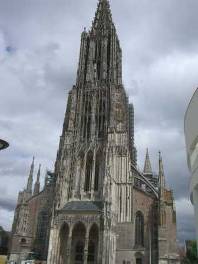
Ulm was the largest city we'd visited in quite some time. One thing we especially like about Germany is the ease with which you can ride into and out of a city. One like Ulm has bike paths all along the river. So there's no need to fight traffic. In places where there is no specific bike path there'll be at least signs indicating which route is bike friendly. These radwegs, as they are called, cover Germany from end to end through virtually every little town. The only problem we had was that sometimes there were too many signs and you had trouble deciding which to follow. Anyway, despite its size, Ulm was a breeze to enter and leave.
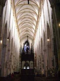
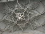
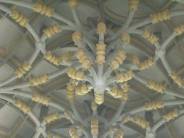
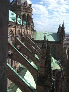
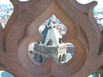
Ulm is also home to a fabulous late French Gothic style church. It is famous because it has the tallest church spire in the world. Late French Gothic has to be the most imaginative form of architecture ever developed. It almost seems as though the stone masons were challenging themselves to see just how far they could go. The earlier Gothic structures we'd seen are much plainer in appearance. They're interiors have the tall vaulted ceilings, but the exteriors are much les decorated. The height and simplicity of the interiors almost give the impression of being in row of tall redwoods. You're eyes are drawn upwards to the sky, but there's just ceiling, no painting.
Yet the true function of the Gothic style was to create a church with such thin walls that windows could be used to fill the walls with colored light. Having such thin walls meant the columns had to carry the weight of the roof. Since the load of the roof wants to push the walls outward, external wall support in the form of those huge flying buttresses had to be added. Of course this just gave the stone masons more surfaces on which to carve their extravagant figures.
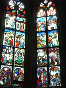
Inside these late Gothic c hurches are still less dramatically decorated than their Baroque counterparts. Instead of gold guiding and busy paintings, the splendor comes from all those magnificent stained glass windows. On sunny days they sparkle and shine like jewels giving the place a rather ethereal sense.
Looking closer at these windows, you can see that it is not just the glass that gives them their splendor. The artists would first fit colored glass into the lead bridge frame forming the general shape of the feature they are trying to create. Then they would paint on the rest of the details, facial features, folds of cloth, building materials, etc. The better the artisan the more refined these painted-on details. It almost seems that the true artistry of stained glass is not the glass work itself but the painting added later.
Centuries and millennia ago Churches seemed to be treated almost as a living entity. They were never static or quite finished. Although a church may start under one architect and one set of craftsmen, its construction would extend hundreds of years beyond their deaths. New architects and craftsmen would move in. New patrons would provide the funding. As time passed new styles came and went and the construction of these major projects would veer from one plan to the next. Alterations, modifications, additions, reconstructions, renovations lead to a church with so many different styles it's often difficult to classify it under a single genre. In the end this was probably the best way for these monoliths to develop. They rely do reflect the living and changing ways of their community.
All that has changed. With monies now coming more from the tourist trade rather than from wealthy donors, church properties, or outright taxes, the funds available for new constructions just isn't there. Also, there seems to be no desire to make changes to the overall appearance, after all that's what brings in the tourists in the first pace. So now the churches have become almost static. All construction is aimed at just preserving the appearance as it is, not updating it in any way. You might say that the churches have now become almost static figures reflecting tastes and styles of years gone by.
Is this a good thing? Maybe. Much of modern architecture seems to be built for the short term. Styles become dated and old within a matter of decades rather than centuries. Just witness the geodome house craze of just a few years back. Already these things look old and odd. So maybe it's a good thing that modern architects aren't getting their hands on these old treasures. Also, apart from doing renovation and maintenance, what community could afford such a huge structure to begin with? Very few.
Between the numerous rain showers, day after day, we
finally got to within spitting distance of Donaueschingen, the end of the Donau.
Just 14 km east of there is a small community campsite specifically created for
the radweg users. It has picnic tables, a large bar-b-cue grill, a small hut
to get out of the rain, and flush toilet facilities housed in a mobile
trailer. The barrier is supposed to keep cars out, but it seems that rule gets
ignored a lot. A large group from France had pulled in with their van and
trailer and completely filled both drying hut and most of the tables. A city
employee gave
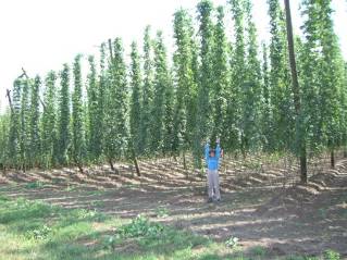
Donaueschingan has a few things to offer the tourist but perhaps the most evident is the brewery. You can smell the hops stewing throughout the entire town. It also has one museum that is supposedly fid with an eclectic variety of things, a palace, and lots of half timber buildings. Otherwise there's not much of interest to the international tourist, just the famous Donau. So we stopped to get photos at the point where the Donau ends and splits into two upstream rivers, took a short walking tour, ate lunch, bought food, and headed on toward the west.
The Rhine and Eastern France
Donaueschingen, DE to Corney sur Moselle, Fr August 16 to August 24
Our goal was to pass through the Black Forest on our way to Strasbourg. This is the famous Black Forest that we'd heard so much about. Getting to it was a little tricky as the nicely signed bike routes had petered not too far west of Donaueschingen. There are bike routes, just not in the direction we were going. So we wound up on some mighty busy roads for a while. When we did finally get on bike routes we promptly got lost. Even though Germany has a plethora of signed bike routes it seems that often the signs are missing right at critical junctions. So rather than staying low and by the highway as we passed Titisee and Hinterzarten, we wound up climbing high into t he hills right into the middle of the forest. We got far deeper into the midst of the Back Forest than we'd ever intended. The ride down to Freiburg did make for one great run down a very nicely maintained dirt road.
Surprisingly the Black Forest really wasn't all that exciting after all. It's simply a managed forest area. Just like National Forests in the US it is one gigantic tree farm. In fact, we saw evidence of logging all over the place. It's full of dirt roads and tourist towns. It would be easier to feel that you are out in a real wilderness in the US western National Forests than it is in the Black Forest. We really do feel we are so fortunate to have our forests especially after seeing how crowded those of Europe can be.
Riding up the Rhine is nothing like riding up the Donau. For one thing it's no where as popular. You see a few bikers, but not the hordes we saw in the east. Probably the main reason it's not as popular is the towns aren't all that close to the river. Unlike the Donau which is tightly channeled and has cities all along its bank, the Rhine valley is quite wide. The old towns and cities grew up far from the river banks mainly because the river has a tendency to flood and wander. It's not until you get to Strasbourg that you come to any really substantial community. In fact, while wandering the streets off the Rhine looking for a supermarket, we learned from an old man in a car who spoke broken English that there were none around. Best to go on to Strasbourg, he said.
Strasbourg is an interesting, happening city that also has some of that seediness that border towns so often have. On one side you have the German town of Kehl which provides a stark contrast. It's got the usual 3 or 4 discount supermarkets and just one normal store. We noticed that the French will come over on the bus with huge empty duffel bags to be filled with the far less expensive groceries. We also discovered that Khel has far more camera shops than even the most tourist part of downtown Strasbourg.
Our camera broke. We were in the cathedral taking pictures. Suddenly it made a funny grinding noise and just shut down with the lens still extended. We needed to find a camera shop to a. find out what happened, b. see if it could be fixed, and c. get the lens retracted. Finding a camera shop was nearly impossible. In the downtown Strasbourg area there is not a one, a surprise considering the much smaller Khel has 2. People at the tourist office sent us out in one direction after another and still no camera shop. Finally, after about 2 hours wandering back and forth, they directed us to an electronics s tore that sells digital cameras. They couldn't fix the camera, but they did get the lens retracted and told us that the lens motor was toast. This was so disappointing. We'd been having so much fun making movies and the kind of photos we'd never before been able to make. We'd have to find some cheap replacement and arrange to send the other one back to the warranty department after the tour. Bummer.
As with so many places in Europe there are lots of museums in Strasbourg to visit and all are very good quality. We bought a one day museum pass and managed to squeeze in 2 1/2 select places and that was only by starting at the opening bell and concentrating hard on getting through. They all were quite extensive.
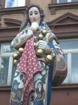
One museum focused on Strasbourg artists through the ages. Of particular interest were the stained glass and statues. Strasbourg evidently was a center for stained glass production for many centuries. The examples they have go way back to the very beginnings of the art. The detail of the painting got better and better as the ages progressed. All examples are mounted in wall frames with diffused backlight so you can really see the colors and brush strokes. We were particularly impressed with the intricacy of some of the finer details, such as locks of hair or folds in cloth. The statues housed in the museum are mostly originals coming from the cathedral. They were either removed during upgrades in the church's decor or replaced with copies. At one time the cathedral was used by Protestants, so some of the features of the protestant style church are contained in the museum as well. It was interesting to see the statues up close and get some insight into the symbolism provided by the audio guide included in the entrance price.
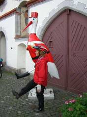
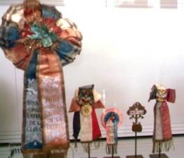
The Alsatian museum had articles from everyday Alcase life in a house that is of typical Alcase construction. One item showcased was the dress of the women, in particular those famous huge black hair bows. They started as a small ribbon with bows on either side of head in 1800s. Gradually they grew in size becoming the huge bow requiring under wire to keep its shape. After 1920 the custom of wearing the traditional bow was pretty much abandoned. You now see them only in museums and traditional dance shows. Other things showcased in the museum were construction techniques, the cycles of life for the locals, a wine press, some farming equipment, and a range of other utensils used in former times.
One final museum, the one we only got to see half of, was the archeology museum. It proved to be much larger that we'd anticipated so we simply ran out of time. It goes back 100,000s of years to the earliest hunter/gatherer society and gradually works its way forward in time. We only got as far as the Gallo Roman time. It was surprising to see just how much Roman presence there was in this region. Someday we hope to get back and finish this museum properly.
We moved out of Strasbourg the following day, leaving behind a muddy spot where our tent had been parked for 3 nights. It'd been so wet and rainy for the past month that the campgrounds were basically turning into mud bogs. Even if you place your tent on a spot that appears to be grassy your steps will soon smush all the grass into the mud. Everything soon turns into a muddy mess. We were getting very, very close to reaching our limit on this weather.
A paved bike path leaves Strasbourg and runs about 60 km or so westward along the Marne au Rhine canal. It's a great way to head west as it takes you right through the hills on a pleasantly flat route. Just west of the town of Lutzelbourg We came across one of the most unusual canal structures we'd ever seen. Wandering through the little town, Brian takes a look at a tourist information sign and then comes trotting back to where I was standing. "You have to see this." he declares, "I've never seen anything like this before."
He was looking at a picture of the Plan Incline. Originally in this region the canal had a total of 17 locks designed to raise canal boats around 10 feet each. Around 40 years ago the French government decided to replace all these lock with a single boat elevator. That's right, a boat elevator. It is literally a piece of canal that can be raised or lowered along tracks running up the side of a hill. It carries up to 3 of the shorter canal boats at one time plus all the water of that short canal section. Just imagine the motors and counter weights needed to lift that load. From an engineering perspective this was one of the most unusual sights we'd come across all summer. Just wish we'd had a camera to get a shot or two.
After the canal tow path turned into nothing more than a muddy track, we gave up and headed overland on the white roads. We started noticing that folks in this region seem particularly helpful. Even without asking we keep getting directions. First one old lady by the canal told us how to get up to the city. Another lady at Arzviller even went so far as to find someone else who spoke some English to give us directions. The extreme was when we stopped in at the Decathlon sporting goods store. We'd been looking for some more chain lube, but this fellow assumed we wanted a grocery store so he gave us directions. It wasn't what we'd stopped for in the first place, but it was nice of the fellow to help out.
Our ride cross country to the town of Corney sur Moselle was generally accompanied by some of the best weather we'd seen in weeks. Days were mostly sunny and warm and rain came only at night. This didn't mean we were packing up a dry tent each morning. It was wet as ever. It just meant that we weren't getting soaked during the day's ride. The terrain was a never ending undulation of rolling hills mostly covered by ripening corn fields. Towns in this region seem poorer and more rundown than we'd seen elsewhere. But this is a region of France that has experienced war destruction time and again. In fact the place we camped is right by a monument dedicated to the US army who painfully crossed the Moselle in September 1944 on its way to defeating the Germans. The WWI site of Verdun is just a few km away. So anything of any age has probably been destroyed.
World War I
Corney sur Moselle, Fr to Calais, Fr August 25 to August 29
We finally gave up on the weather. The reports we were looking at seemed to indicate that this eastern region of France was not going to get out of its endless spell of rain anytime soon. Also, in looking at the total distance to ride up to Calais and then down along the coast to the Bretagne region and on southward to Birratiz, we concluded it was just too far to go. Also, these rolling hill and farm lands do not exactly make for the most interesting riding. If we wanted to spend our summer riding through corn fields we could just as well do that in Indiana and save ourselves a lot of time and money. It was time to do something else.
We looked at taking a train to Calais. If we took the less expansive route we'd have to go through Paris, changing from one train station to another in the process. This was not an exciting prospect. To go the other route would entail passing through Luxembourg and Belgium again changing stations in Brussels. We then looked at a car rental. As we so often discover, the cost of a one or 3 day car rental one way to Calais proved to be just about the same cost as the train ticket price for 2 people. So we decided to rent a car. But rather than just stop at Calais, we decided to go to the far western reaches of France with the hopes of finally finding a place out of the rain. We'd take a week, stop to visit WWI and WWII sites along the coast, and get ourselves all the way over to Brest. Besides, after 4 months constant riding, it'd be nice to have a motor for a short time.
Our first stop, however, was back to Germany where we finally found the cheapest camera, digital at that, that we could find. Still at 49 euros, it still was rather pricey compared to what you can get in the US these days.
At first everything happened fast. Germany invaded Belgium and quickly marched on Paris. They came ever so close before the French, with the aid of the Brits, finally repel led the attack. They were able to push the Germans back as far a Verdun. Then the whole battle became almost a leap frog game as each side tried moving a bit further north to get around the other. In no time the front line of long trenches was stretched all the way from Switzerland to the English Channel. Everything went into a sate of stalemate with neither side having an advantage, neither side having any good way around or through, neither side moving anywhere.
There they sat from 1914 to 1918. Various attempts by the generals, sitting safe and secure way back of the front, to break the stalemate all ended with horrendous loss of life and virtually no gain in territory. Millions died in battle while millions more suffered and endured horrible conditions down in their long, muddy trenches.
When the US entered the war in 1918, both sides were essentially spent. Popular support for the war had waned. Resources were stretched to the limit. Troops were physically and mentally exhausted. Fresh recruits were hard to find. Kaisers and czars were close to being toppled. Upon entering the conflict the US essentially gave the allies a huge boost in the arm which allowed them to quickly shove their way through weakened German defenses. Yet, it was never a sure bet that the US would join the Ally side. Relations with the English had never been that strong, they had no beef with the Germans, and the chummy relation with the French had cooled a bit. The US could have sided with the Germans or have continued to stay out of the conflict altogether. The Germans made a great big booboo by attacking the Lusitania. What did that Japanese general say in WWII, "We have awakened the sleeping giant."
So even though the US may look upon itself as the savior of Europe in WWI and WWII, an interesting alternative would be to ask what would have happened had the US not entered WWI? Is it possible that just our very action of helping the allies gain such a decisive victory may have, in fact, guaranteed that WWII would happen?
Even though the entire war was pretty much restricted to European soil and waters, it's called a World War because of the participants. With the exception of Germany, most of the countries had colonies scattered across the globe and they all called upon citizens from those colonies to take up arms.
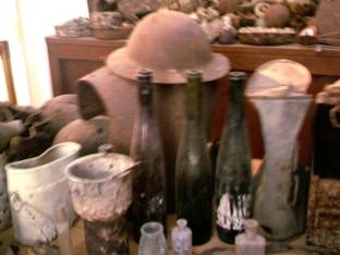
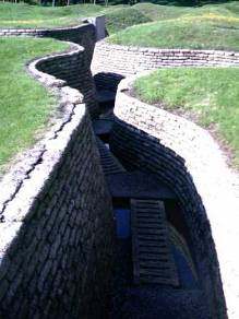
The region we were in, northeastern France, is right in the middle of that long, stagnate, line of trench warfare. So there are ware monuments and memorials all over the place. In fact, it is also quite common for the farmers to still dig up all sorts of war relics every year just by plowing the fields. There was stuff all over the place. Following the war, most of the trenches were filled in and plowed over as fast as possible. It was as if the French wanted to forget the whole incident. However, in typical new world fashion Canadians turned 2 of their sections of the battle field into US and Canada style monuments. The remains of the trenches can still be seen and there are explanations and free guided tours. These are found at Vimy and Beaumont-Hame.
The Beaumont-Hame site, named for the two tiny towns
nearby, was originally a battle field and memorial for the Newfoundlanders who
fought and died here. It was another one of those cases of idiocy and
stupidity that caused all but 68 of the 800 Newfoundland soldiers to be killed
or injured on this site. They were scheduled to go in to battle as a second or
third wave in another of the useless attempts to break through German lines.
By this time the communication tunnels
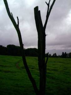
The memorial is striking. An elk, symbol of Newfoundland, stands high on a manmade rocky mound facing toward the German line, where the soldiers were headed. Danger tree still sits, dead and foreboding, out in the middle of the field. Small white graves in neat rows, sometimes shoulder to shoulder as the deceased underneath lay, sit in the Y ravine. And most disturbing are the grass covered pockmarks and trenches, evidence of an Earth severely tortured during the war.
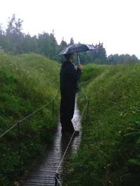
We walked these trenches in a rainy downpour. The ground underfoot was so soggy it felt like we were walking on sponges. It was chilly, damp, wet. Yet despite our discomfort, it was nothing compared to the horror of WWI.
The Vimy site, also run by the Canadians, is a little different. Its primary importance to the Canadians is the fact that this is the place where all 4 of the Canadian forces fought together for the first time on July 7, 1914. It wasn't the site of a single, massacre type event. Much of the small section of trenching has been restored and well maintained, both ally and German sides. It's rather startling to see just how close the two lines really were. You hear stories of people listening to each others conversations and when you're there you can actually believe it happened. The two sets of trenches are lined with sand bags turned cement, so you can still see the depth and regularized nature of the walls. They're not as eroded as Beaumont-Hame. Also, some of the underground tunnels are open for guided tours.
The tunnels are the most interesting aspect at Vimy. As you'd expect, it was a mining engineer who came up with the idea of creating an entire brigade of soldiers whose job was to build tunnels. They created a three level honeycomb of tunnels all along the front, each set having a different purpose. There were the tunnels reaching forward beyond the front line. There were stuffed with munitions and blown up in an effort to stop German tunneling or to destroy some strategic target. There were service tunnels, dug deep for safety. And there were the fighting tunnels, near the surface for supplying the trenches. The tunnels had officer's quarters, mess halls, communications centers, water supplies, small hand run rail carts, you name it. There were the trenches above and a living city working below. What an astounding system.
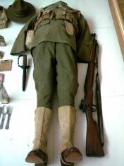
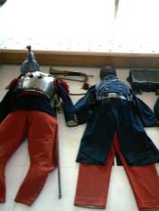
In the town of Peronne we visited the Historial de la Grande Guerre. Appropriately housed in an old fortified castle, this museum attempts to tell the story of this first ever modern war from both sides without any prejudgment. One thing it makes clear is that neither side was anywhere near prepared for the change in warfare practices the most recent innovations would bring about. The horse, single shot rifle, and stationery cannon were on their way out. The machine gun, tank, and airplane were in. The machine gun, in particular, was especially devastating.
You can see just how unprepared the militaries were at the outset of the war by looking at the uniforms splayed out on the floor. The early French uniform was a complete joke. The soldiers were given bright red jackets and blue pants, an absolutely perfect target to be mowed down by machine gun. The Brits were somewhat better outfitted. Having just fought in some desert skirmishes their colors were at least drab. However, their uniforms weren't rugged or sufficiently warm. Nor did they have the equipment they'd need for long term trench war. The Germans were best prepared, but even their outfits went through modification. Only the Americans came in the best prepared from the start and that's only because they'd been watching the battle from afar for so long. World War II
Calais, Fr to Kermana-Sulard, Fr August 30
Leaving WWI behind, we drove northward to Calais and then turned southwest to take a coastal tour. One thing you don't realize until you're standing there is just how close France really is to Britain. As you stand on the coat you can see the white cliffs of Dover without even needing binoculars. You can see why there has been continual battle for control of this region of France for centuries.
Calais is probably one of the busiest naval transportation hubs of the world. Hundreds of ships pass this short expanse of English Channel each day, many of which are just doing the short 45 minute crossing from continent to island. Of course nowadays there's the chunnel that adds train traffic to this busy crossing as well. The French are all set up for this onslaught of British travelers. Near the Chunnel station there is an enormous shopping center where the Brits can shop to their hearts content. Prices in Great Britain are absolutely astronomical compared to even France, which we find to be high by US standards. Liquor is especially cheap for the Brits. Currently there is no limit as to what a British citizen can bring back. So you see them at the grocery store picking up cases upon cases of wine in particular which is amazingly cheap in France, one of the few things we find cheap. Everything else from clothes and cheese to electronics and gasoline are all significantly cheaper in France than England. In fact we heard one Brit say that they call it Treasure Island because the businesses are ripping people off so much. In fact they say that until recently car prices were running some 50% higher in England, until so many people were going to the continent to buy vehicles that the government actually ordered an investigation. The only thing we have to wonder is when and why did England, and all of Europe for that matter, get to be so expensive?
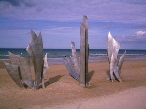
Continuing our war themed car tour, we headed to the beaches of Normandy to see the place where, on that fateful day in 1944, the US, British, and Canadian forces set foot marking the beginning of the end of German occupation. Unlike WWI, WWII is a case where the French and British would never have won had the US not entered the fray, although until Pearl Harbor, people in the US were not all that excited about entering another European war.
The beaches are spread along an approximately 50 mile length along the base of a narrow peninsula to the north west of the Normandy coast. The Germans had been expecting an offensive to come near Calais, the shortest distance between England and France. In fact, the Allies spent a lot of effort trying to encourage this belief including building dummy airbases in England. Instead when the some 8000 ships rendezvoused in the English Channel, their objective was further west, a much less well defended section of beach.
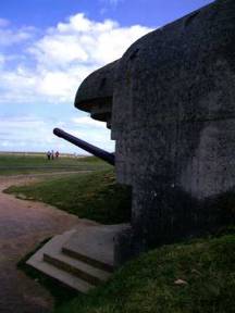
It's hard to imagine just how difficult the landing on Omaha beach was until you actually stand there. The Germans had learned a lot from their
defeat in WWI and had worked on perfecting the cement bunker to a tee. These
bunkers, some of them obviously mass produced else where and brought on-sight,
placed the occupants well out of firing sight. Without modern computer aided
tracking, it was nearly impossible for any missile or bomb to get into these
bunkers with normal ballistic trajectories. They were greatly reinforced on
the tops so that anything dropped from above could not get through, at least
anything made back then. They were nearly impregnable. Just about the only way
you could take one out was to have
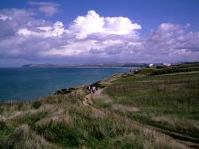
The other factor working in the German's behalf was the terrain itself. When you think of the beaches of Normandy it's easy to think of a long expanse, very wide, flat, just big, area. The reality is, this is a very narrow beach merely a few yards wide, 10 at most, that at that time had just a small pebble bern providing protection. Where the beach ends, the cliffs begin and the Germans had bunkers all over these. The only paths away from the beach were 4 small canyons which today have narrow roads used by beach goers on weekends. No sooner are you up the cliffs then you hit towns. These are the usual old style European farm villages with stone wall or hedge row lined roads. This is only about 100 yards from water's edge. Everything is so close to that beach and it was so easily defended. Thousands of American GIs died that day many of which never made it to shore. We wondered, if you were scuba dive along this coast just imagine all the war paraphernalia you could dredge up. There are even some 20 odd tanks down there somewhere.
The invasion of Normandy really did last pretty much 1 day. Securing the very fortified bunkers of Pont du Hoc took anther couple of days. From that point onward it was just a matter of days before the allies had the peninsula secured and they were rapidly on the move eastward. Hundreds of thousands of troops and tons of equipment was shipped to and unloaded at the 2 artificial ports created there. One was destroyed a few months later in a storm. Remains of the second can still be seen. It wasn't too long before the Germans were surrounded and surrendered.
Mont St. Michel
Kermana-Sulard, Fr to Brest, Fr August 31
Today it has been connected to the mainland by a causeway. This causeway has caused the redirection of the tidal and river flows so that the former high tide island is rapidly becoming just a lump on the beach. Major work is being undertaken in an effort to stop the silting and return this tourist attraction to its former somewhat water surrounded state. They're probably afraid that it'll lose its attraction and they'll lose the tourist bucks. Try as they might, wanna bet it doesn't work. Mother Nature always wins.
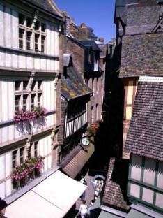
This is a sight that is absolutely jammed with tourists, to the point where it's not even fun to visit. We arrived and were properly stunned by the remarkable sight of this sand castle appearance sitting out from the shore. But, it tends to lose its attraction when you try to squeeze through the throngs of people jamming its one major narrow street shoulder to shoulder. We could tolerate wandering around for an hour or two, but soon we'd had enough and just wanted out. This is clearly one of those sites best visited in late November, when it's cold, dark, and nobody else is about. We'll try it again at that time.
It was actually a relief to drop the car off in Brest making it once again someone else's responsibility. We just found that driving in France when you're trying to avoid using their expensive Autoroutes is difficult and tiring. Let's just say it clearly is not a one man job. You literally have to have a navigator keeping an eye on the road and a map at all times. You can't simply sit back and watch the scenery whiz by. Signs at each round about usually indicate some town that this road leads to. The problem is sometimes it's the very next town, sometime it's some more major juncture further down the road, sometimes it's the big city all the way in the next district. Often more than one town is indicated and you don't know what towns will be featured until you get right to the turn off. There'll be a long list of about 4 or 5 towns and you have just seconds to run through the list and determine if any matches what you are looking for. A lot of times none match. Sometimes there's a route number. But consistency with the route number is not a French trait. You'll be going on D307 and without your even knowing it may change to D51 at some obscure intersection. Sometimes one road can have up to 3 different numbers associated with it and often the maps don't show them all. Or maybe the route number on the map doesn't match the sign at all. After making multiple wrong turns, many U-turns, lots of back ups, lots of stops to read the map we concluded that the best type of RV type vehicle for Europe has to be small, small, small, a van or pickup length at best. Anything else would be a nightmare on these back roads or you'd spend a fortune on highway tolls.
Appendix A - Route
Germany
August 1 Inntal radweg through Poling, Altoting, Marktl, Stammham, Kuchdorf, Simbach to Braunau - 58.32 km August 2 - Innatal bike route through Ering, Algen, Egglfirg, Neuhaus, Neuburg, to Passau, 77.25 km August 4 - Donnau bike route north side of river through Hofkirchen, Mittenndorf, Winzer, Niederalteich, Deggendorf, to Kleinschwarzach, 72.58 km August 5 - Donnau bike route north side to Straubing, 30.00 km August 6 - Donnau bike route north side through Sossau, Pittrich, Oberzeitdorn, Niederachdorf, Oberachdort, Kietenholz, Frengkoton, Demling, Donaustauf, to Regensburg, 58.61 km August 7 - Donnau bike path through Bad Abbach, Saal, Kelheim, Bad Gogging, Neustadt, Wackerstein, to Vohburg, 78.43 km August 8 - Donnau bike path through Gros Mehring, Ingolstadt, to Neuburg, 42.57 km August 9 -Donnau bike path through Bittenburnn, Stepperg, Bertoldsheim, Maxheim, Lechsend, Graisbach, Altsheim, Zirgsheim, Donauworth, Erlingshofer, Retingen, Gremheim, to Dillingen, 78.76 km August 10 - Donnau bike route through Lauingan, Gundelfingen, to Gunsburg, 34.53 km August 11 -Donnau bike route through Ulm, Erbach, Oberdischingen to Ersingen, 53.15 km August 12 - Donnau bike route through Ehingen, Munderkingen, Untermarchtal, Obermarchtal, Daugendorf, to Riedingen, 59.71 km August 13 - Donau bike route through Althem, Waldhausen, Binzwangen, Mengen, Ennetach, Scheer, Sigmaringen, Gutenstein, Neldingen, to Hausen, 66.34 km<BR> August 14 -Donau bike route through Werenweg, Feldingen, Muhlheim, Nendingen, Tuttlingen, Mohringen, to Immendingen, 52.69km August 15 - Donau bike route through Immendingen, Zimmen, geisingen, Gutmadingen, Naudingen, Pfohren, to Donaueschingen, bike route to Hufingen and Braunlingen, back roads through Waldhausen and Unterbrandto Kirnbergsee, 44.54 km August 16 - Back roads through Dittishausen, Rt 31 briefly, backroad throgh Friedanweiler, Rt 31 to secong Neustadt exit, back roads to Titisee, Hinterzarten, and Alpersbach, forest roads to Rinken, Zaster, backroads through Oberried to Kirchzarten, 63.23 km August 17 - Bike paths through Freiburg, Unkirch, Botzingen, Ihringen, Breisach, north along the Rhin bike path to Sasbach, 60.18 km August 18 - Rhine bike path through Weisweil,Oberhausen, to Kehl, 81.36 km
France
August 21 - Canal du Marne au Rhin bike trail through Strasburg, Saverne, Lutzelbourg, 73.4 km August 22 - D98 to Arzviller, Guntzviller, D45 to Niderviller,Buhl-Lorraine, Canal path through Schneckenbusch, D44 to Sarrebourg, D27 to Rorbach-les-Dieuze, D38 through Dieuze to Vic-sur-Seile, 82.48 km August 23 - D174 to D77 to Chambery, Bioncourt, Lanfroicourt, Array-et-Han, D913 to Nomeny, D70 through Rouves, Eply, Cheminot, D5 to Sillegny, D57 through Lorry-Mardigny, Arry, N57 to Corny sur Moselle, 82.49 km
Appendix B – Campsites or Hotels
Austria
August 1 - Camping at Braunau (14.80 E/night)
Germany
August 2, 3 - Camping at passau (12.00 E/night) August 4 -Farm camping at Kleinschwarzach (15.00 E/night) August 5 - ADAC camping in Straubing (12.00E/night) August 6 -Regensburg camping (21.00E/night) August 7 - Simple camping at Vohburg August 8 - Newburg rowing club camping(12.00 E/night) August 9 - Camping and gasthaus Delingen (11.30 E/night) August 10 - Naturfreundehaus camping in Gunsburg (15.00 E/night) August 11 - Ersingen rowing club (12.00 E/night) August 12 - Farm camping near Riedlingen (10.00 E/night) August 13 - Camping at Hausen, (13.00 E/night) August 14 - Community naturpark at Immendingen August 15 - Camping at Kirnbergsee (16.00 E/night) August 16 - Karhaus camping at Kirchzarten (17.60 E/night) August 18, 19, 20 - Camping at Kehl (13.20 E/night)
France
August 17 - Camping at Sasbach (10.60 E/night) August 21 - Camping La Plane Incline, Lutzelbourg, (12.50 E.night) August 22 - Camping les Tuileries, Vic sur Seille, (10.70 E/night) August 23, 24 - Le paquis, Corney sur Moselle, (7.80 E/night) August 25 - Camp municipal Malliong, w/car (11.40 E/night) August 26 - Camping e Mont Banc in Charville-Mezieres August 27 - Camping Municipal e Velodrome, Albert (8.20 E/night) August 28 - Camping municipal Calais, (9.64 E/night) August 29 - Camping de la Plage, (17 E/night) August 30- Ferme camping (10.90 E/night) August 31 - Camp Municipal Kermana-Sulard September 1, 2 -Camping Goulte, Brest(15.00 E/night)
References Lonely Planet France Guide |
|
Copyright © 1995-2011 by Caryl L. Bergeron - Distribution for personal use permitted. Distribution for other uses with written permission.
Acknowledgements
|
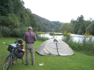
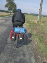
 In 1999 we rode the
bike route from Branau to Passau on the Austrian side of the Inn River. This year we chose to ride it on the German side just to see what differences there
might be. There is a definite difference in the towns. The Austrian villages
always seem so absolutely perfect whereas the German ones more real. Also, the
German bike route only stays on the banks of the river in sections. Most of it
is dirt which, since we'd started having nearly nightly rains, meant that some
of it was a bit muddy. But otherwise it was a nice, flat ride through farm
fields the entire way.
In 1999 we rode the
bike route from Branau to Passau on the Austrian side of the Inn River. This year we chose to ride it on the German side just to see what differences there
might be. There is a definite difference in the towns. The Austrian villages
always seem so absolutely perfect whereas the German ones more real. Also, the
German bike route only stays on the banks of the river in sections. Most of it
is dirt which, since we'd started having nearly nightly rains, meant that some
of it was a bit muddy. But otherwise it was a nice, flat ride through farm
fields the entire way.
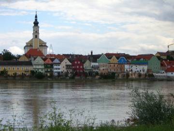
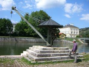
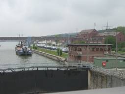 Within a day the
weather partially cleared, or at least enough for us to ride westward. In the Passau area the Donau is an enormous river. Passau itself sits on a point where the Inn and Donau meet. The Inn is a muddy color while the Donau is somewhat clearer. There's
a mini meeting of the waters where the muddy Inn and clear Donau flow
side-by-side for about 1/2 km or so. Large cargo vessels and those gigantic
cruise boats flow up and down river from this point. We would watch the Donau
grow smaller and smaller as we headed upstream. Bike tourists abound, most
seeming to head downriver as that's the direction recommended on our maps.
Within a day the
weather partially cleared, or at least enough for us to ride westward. In the Passau area the Donau is an enormous river. Passau itself sits on a point where the Inn and Donau meet. The Inn is a muddy color while the Donau is somewhat clearer. There's
a mini meeting of the waters where the muddy Inn and clear Donau flow
side-by-side for about 1/2 km or so. Large cargo vessels and those gigantic
cruise boats flow up and down river from this point. We would watch the Donau
grow smaller and smaller as we headed upstream. Bike tourists abound, most
seeming to head downriver as that's the direction recommended on our maps.
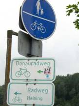
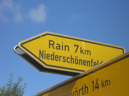
 The next day we
continued to follow the zigzag route of the Donau bike route westward. Since
this is a bike route using mostly existing roads and paths, it doesn't
necessarily stay alongside the river the entire way. At times you are right on
top of the dyke, while at others you may be a km or so away. You just have to
be constantly on the lookout for those yellow Donau Radweg signs to make sure
you're on the right track.
The next day we
continued to follow the zigzag route of the Donau bike route westward. Since
this is a bike route using mostly existing roads and paths, it doesn't
necessarily stay alongside the river the entire way. At times you are right on
top of the dyke, while at others you may be a km or so away. You just have to
be constantly on the lookout for those yellow Donau Radweg signs to make sure
you're on the right track.
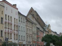
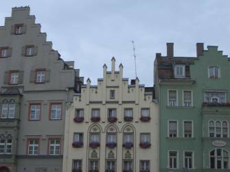
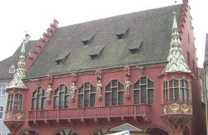
 Straubing
is about as typically Bavarian as can be. Houses have very steep roofs and 4,
5 or even 6 stories. The fronts of the buildings often have stepped or curved
false fronts. The many windows are lined up in neat rows and decrease in size
from bottom to top. Walls are stucco and usually painted a cream to tan
color. They are neat, tidy, and very regular.
Straubing
is about as typically Bavarian as can be. Houses have very steep roofs and 4,
5 or even 6 stories. The fronts of the buildings often have stepped or curved
false fronts. The many windows are lined up in neat rows and decrease in size
from bottom to top. Walls are stucco and usually painted a cream to tan
color. They are neat, tidy, and very regular.
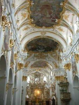 We
stopped at Regensburg just as it began to rain once again. With a bit of
planning we were able to dodge the rain spells while taking in th e usual
walking tour of the old town. It's a nice town that has a plethora of museums
you could visit. But again without some sort of independent guide giving some
indication as to which were worthwhile and which weren't, we were reluctant to
sp end a lot of money museuming at this time. We'll save it all for a return trip
with guidebook in hand.
We
stopped at Regensburg just as it began to rain once again. With a bit of
planning we were able to dodge the rain spells while taking in th e usual
walking tour of the old town. It's a nice town that has a plethora of museums
you could visit. But again without some sort of independent guide giving some
indication as to which were worthwhile and which weren't, we were reluctant to
sp end a lot of money museuming at this time. We'll save it all for a return trip
with guidebook in hand.
 What really was a
surprise was the small number of bikers who camped at all. We remember from
our 1999 trip from Vienna to Passau all the large biker oriented campgrounds we
passed and stayed in. We always thought it'd be a real zoo in July and
August. But not so. It seems as though all those pack laden bikers we see all
day long don't actually camp. They're gasthaus people. Well, so much the
better for us.
What really was a
surprise was the small number of bikers who camped at all. We remember from
our 1999 trip from Vienna to Passau all the large biker oriented campgrounds we
passed and stayed in. We always thought it'd be a real zoo in July and
August. But not so. It seems as though all those pack laden bikers we see all
day long don't actually camp. They're gasthaus people. Well, so much the
better for us.
 The canyon is a big
tourist attraction. People take boats up and down the canyon for a distance of
not more than 2 or 3 km. A cloister located at the end of the canyon now
houses a restaurant and museum where all those boat happy tourists can get
their fill both visually and physically. Although it seemed to us that a lot
of folks were just content to walk up and down the riverside paths. To get to
the cloister, the official bike path takes a steep climb up a dirt road going
around the canyon up on its highest walls. Although you can, for a fee of
course, put your bike on one of the tourist boats for a one way trip. We did
the ride as it made for a fun, short mountain bike section.
The canyon is a big
tourist attraction. People take boats up and down the canyon for a distance of
not more than 2 or 3 km. A cloister located at the end of the canyon now
houses a restaurant and museum where all those boat happy tourists can get
their fill both visually and physically. Although it seemed to us that a lot
of folks were just content to walk up and down the riverside paths. To get to
the cloister, the official bike path takes a steep climb up a dirt road going
around the canyon up on its highest walls. Although you can, for a fee of
course, put your bike on one of the tourist boats for a one way trip. We did
the ride as it made for a fun, short mountain bike section.
 Continuing westward
along the river we passed through many cute little old towns along the way, all
having the same Bavarian style houses and layouts. Rain continued to plague
our every move as well. We passed through Ingolstadt, a modern town with not
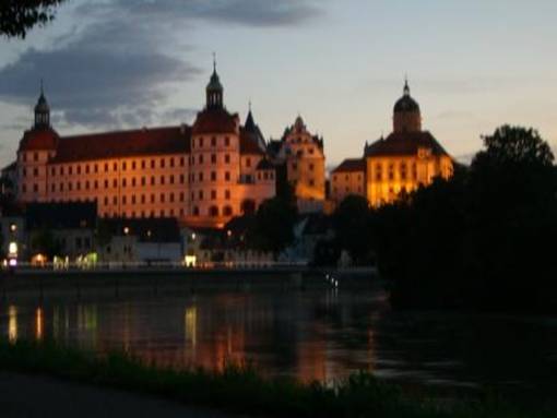
much of interest. Then there was Neuburg and Donauworth, all towns with the
normal Bavarian style architecture. It wasn't until we got to the city of Ulm that we saw much of a change. But, then, it is at the western edge of the Bavarian
region.
Continuing westward
along the river we passed through many cute little old towns along the way, all
having the same Bavarian style houses and layouts. Rain continued to plague
our every move as well. We passed through Ingolstadt, a modern town with not
much of interest. Then there was Neuburg and Donauworth, all towns with the
normal Bavarian style architecture. It wasn't until we got to the city of Ulm that we saw much of a change. But, then, it is at the western edge of the Bavarian
region.

 As usual the rains
came down in showers all afternoon. Yet we did manage to complete the walking
tour of town in between the drops. Ulm is the first city where we started to
see a break from the stucco front, stepped gabled houses, and regular patterned
market platz. In the old fisherman's quarter there are many of the half timber
style houses we'd be seeing as we progressed further westward. Some of these
old houses were built literally right on the edge of the river and, hence, show
significant signs of shifting. At one point these crooked houses went out of
favor and a Nue Ulm was built on the opposite side of the river, further from
the embankment. But, styles come and go and now the old houses are once again
in fashion. They make great photo opportunities.
As usual the rains
came down in showers all afternoon. Yet we did manage to complete the walking
tour of town in between the drops. Ulm is the first city where we started to
see a break from the stucco front, stepped gabled houses, and regular patterned
market platz. In the old fisherman's quarter there are many of the half timber
style houses we'd be seeing as we progressed further westward. Some of these
old houses were built literally right on the edge of the river and, hence, show
significant signs of shifting. At one point these crooked houses went out of
favor and a Nue Ulm was built on the opposite side of the river, further from
the embankment. But, styles come and go and now the old houses are once again
in fashion. They make great photo opportunities.
 French late Gothic,
on the other hand is architecture gone mad. The churches look like they area
constructed from toothpicks stuck vertically in the ground giving the entire
structure an elongated, reaching for the sky appearance. Everywhere possible
things are carved into the stone. One time when we climbed one of the towers
we noted such creatures as some horned, growling dog figure, or a sneaky gnome,
or a little mouse carved into the stone in a place where only those standing in
exactly that position on the star is might see. There's no way anyone standing
on the ground could view them. These figures were absolutely unnecessary, just
a frivolous addition of the stone mason.
French late Gothic,
on the other hand is architecture gone mad. The churches look like they area
constructed from toothpicks stuck vertically in the ground giving the entire
structure an elongated, reaching for the sky appearance. Everywhere possible
things are carved into the stone. One time when we climbed one of the towers
we noted such creatures as some horned, growling dog figure, or a sneaky gnome,
or a little mouse carved into the stone in a place where only those standing in
exactly that position on the star is might see. There's no way anyone standing
on the ground could view them. These figures were absolutely unnecessary, just
a frivolous addition of the stone mason.

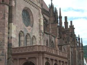
 Renovation is the
big key word. Unlike the ancient Greeks or Romans, who had a predilection for
using such long lasting materials as marble and granite, the Europeans used
sandstone. Sandstone, as its name implies, is nothing more than compressed
sand. Ever dribble water over a sand castle? Just as that sand castle these
splendid Gothic churches are slowly melting away to nothing. Features that
were once sharply defined are becoming just shadows of their former
definition. Saintly figures often have rather ghostly countenances. This is
just after a few hundred years. Compare that to the thousands of years the
Greek statues have survived. So today a lot of churches are now enshrouded in scaffolding
while complete restorations are underway. It was a bit disappointing seeing
church after church covered in metal, however.
Renovation is the
big key word. Unlike the ancient Greeks or Romans, who had a predilection for
using such long lasting materials as marble and granite, the Europeans used
sandstone. Sandstone, as its name implies, is nothing more than compressed
sand. Ever dribble water over a sand castle? Just as that sand castle these
splendid Gothic churches are slowly melting away to nothing. Features that
were once sharply defined are becoming just shadows of their former
definition. Saintly figures often have rather ghostly countenances. This is
just after a few hundred years. Compare that to the thousands of years the
Greek statues have survived. So today a lot of churches are now enshrouded in scaffolding
while complete restorations are underway. It was a bit disappointing seeing
church after church covered in metal, however.
 them a scolding in the morning for not parking outside the
barrier which served them right as their crying baby kept us up most of the
night. Oh how we are looking forward to the start of school.
them a scolding in the morning for not parking outside the
barrier which served them right as their crying baby kept us up most of the
night. Oh how we are looking forward to the start of school.
 It was an easy run
down to the city of Freiburg where we once again ran smack into the crush of
tourist season. It's an interesting city, full of half timbered houses and one
big Gothic church, under renovation of course. The population of Freiburg seems a little strange, though. We'd gotten off the bikes in order to walk the
center rather than run over pedestrians. One old lady chided us for walking
the bikes on the sidewalk. We moved onto the road and in no more than 30
seconds were chided by a biker for walking the bikes in the street. So if you
can't walk your bikes on the sidewalk or in the street, just where can you?
Maybe you're not supposed to walk the bikes at all. Sometimes there Germans
and their stick-in-the mud, you gotta do it my way attitude can drive you
nuts. We left Freiburg with the desire to return someday because despite the
strange people, the town really does look worth a longer visit.
It was an easy run
down to the city of Freiburg where we once again ran smack into the crush of
tourist season. It's an interesting city, full of half timbered houses and one
big Gothic church, under renovation of course. The population of Freiburg seems a little strange, though. We'd gotten off the bikes in order to walk the
center rather than run over pedestrians. One old lady chided us for walking
the bikes on the sidewalk. We moved onto the road and in no more than 30
seconds were chided by a biker for walking the bikes in the street. So if you
can't walk your bikes on the sidewalk or in the street, just where can you?
Maybe you're not supposed to walk the bikes at all. Sometimes there Germans
and their stick-in-the mud, you gotta do it my way attitude can drive you
nuts. We left Freiburg with the desire to return someday because despite the
strange people, the town really does look worth a longer visit.
 World War I, or la
Grande Guerre in France, is one of those tragic episodes of human history that
in hind sight looks like total lunacy. It was a war started by fools, executed
by idiots, and experienced by millions. At the beginning of the conflict, only
France and England had any form of Democracy. Everything else was divided up
into various monarchs. There were the Hapsburgs in Austria, the Czars in Russia, and the Kaisers in Germany. By the end of this 4 year long struggle, all these old
established forms of government would be upturned and replaced by communism, democracies,
and dictators.
World War I, or la
Grande Guerre in France, is one of those tragic episodes of human history that
in hind sight looks like total lunacy. It was a war started by fools, executed
by idiots, and experienced by millions. At the beginning of the conflict, only
France and England had any form of Democracy. Everything else was divided up
into various monarchs. There were the Hapsburgs in Austria, the Czars in Russia, and the Kaisers in Germany. By the end of this 4 year long struggle, all these old
established forms of government would be upturned and replaced by communism, democracies,
and dictators.
 The
whole thing began as a local problem in the Serbia/Croatia region, an area that
is still causing trouble. Due to various alliances, however, it quickly
mushroomed into a Europe wide conflict. There wasn't particularly one single
event that caused the war, despite what is said about the assassination in Zagreb. This was just the trigger. The Hapsburgs came in to get revenge, the French
entered on the other side to defend their interests. The Germans swung into
action to aid the Hapsburgs. Russia joined France. Britain came in to fight
for Belgium who Germany had attacked despite their neutrality. Like a house of
cards, the entire quasi-stable situation in Europe fell apart in a matter of
weeks.
The
whole thing began as a local problem in the Serbia/Croatia region, an area that
is still causing trouble. Due to various alliances, however, it quickly
mushroomed into a Europe wide conflict. There wasn't particularly one single
event that caused the war, despite what is said about the assassination in Zagreb. This was just the trigger. The Hapsburgs came in to get revenge, the French
entered on the other side to defend their interests. The Germans swung into
action to aid the Hapsburgs. Russia joined France. Britain came in to fight
for Belgium who Germany had attacked despite their neutrality. Like a house of
cards, the entire quasi-stable situation in Europe fell apart in a matter of
weeks.
 The war came to an
abrupt end with Germany being the decisive loser. As in previous European
conflicts, to the victor go the spoils. The European economy was in a shambles
having been decimated by 4 years fighting and forcing Germany to make such hard reparations made their situation even worse. Imagine needing a
wheelbarrow of money to buy a loaf of bread, their inflation was that bad.
Also, none of the territorial issues and tensions had been resolved.
Everything was set up and made ready for the conflict that would follow a mere
30 years later.
The war came to an
abrupt end with Germany being the decisive loser. As in previous European
conflicts, to the victor go the spoils. The European economy was in a shambles
having been decimated by 4 years fighting and forcing Germany to make such hard reparations made their situation even worse. Imagine needing a
wheelbarrow of money to buy a loaf of bread, their inflation was that bad.
Also, none of the territorial issues and tensions had been resolved.
Everything was set up and made ready for the conflict that would follow a mere
30 years later.
 that lead up to the
front trench were filled to capacity with the dead, dying, and injured. So
they were forced to go overland, out of hiding. To this day no one knows why
they were ordered over the top, but they were. At first everything went well.
They were on the other side of a ridge where the Germans couldn't see them.
But as soon as they made it to a marker called "Danger tree" they
came within range and site of 3 machine gun nests sitting on high points. They
were cannon fodder, just moved down where they stood. The survivors lived only
by hiding under their fallen comrades and waiting until dark the sneak away.
For some unknown reason the message that the first 2 attacks weren't working
never got
that lead up to the
front trench were filled to capacity with the dead, dying, and injured. So
they were forced to go overland, out of hiding. To this day no one knows why
they were ordered over the top, but they were. At first everything went well.
They were on the other side of a ridge where the Germans couldn't see them.
But as soon as they made it to a marker called "Danger tree" they
came within range and site of 3 machine gun nests sitting on high points. They
were cannon fodder, just moved down where they stood. The survivors lived only
by hiding under their fallen comrades and waiting until dark the sneak away.
For some unknown reason the message that the first 2 attacks weren't working
never got 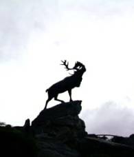 sent to the rear and all these men died for naught.
 The beaches were
given code names, Gold, Silver, and Sword for the Brits and Canadians, Omaha and Utah for the US. Most of the beaches were easily secured within the first few
hours. Except for Omaha that is. US forces met very heavy resistance on this
one short stretch. It's easy to see why these particular beaches were
selected. With just this short section of toe old on the continent secured,
they could quickly move inland to take over a strip effectively cutting off an
entire peninsula. This would give them ample room to bring in all the forces
they needed to march inland and retake the continent. Strategically it made
far more sense than trying to land in Calais.
The beaches were
given code names, Gold, Silver, and Sword for the Brits and Canadians, Omaha and Utah for the US. Most of the beaches were easily secured within the first few
hours. Except for Omaha that is. US forces met very heavy resistance on this
one short stretch. It's easy to see why these particular beaches were
selected. With just this short section of toe old on the continent secured,
they could quickly move inland to take over a strip effectively cutting off an
entire peninsula. This would give them ample room to bring in all the forces
they needed to march inland and retake the continent. Strategically it made
far more sense than trying to land in Calais.
 someone crawl up
there and drop a hand grenade inside, they were that good. Also, they were and
still are everywhere. All along the coast these old German bunkers can still
be found. Some have become a mere nuisance in some farmer's field. Some have
been turned into museums. Some just sit where the tourists can come to visit.
Some are in ruins. Some are in near perfect condition. There were many of
these installations guarding Omaha beach the day US soldiers landed.
someone crawl up
there and drop a hand grenade inside, they were that good. Also, they were and
still are everywhere. All along the coast these old German bunkers can still
be found. Some have become a mere nuisance in some farmer's field. Some have
been turned into museums. Some just sit where the tourists can come to visit.
Some are in ruins. Some are in near perfect condition. There were many of
these installations guarding Omaha beach the day US soldiers landed.
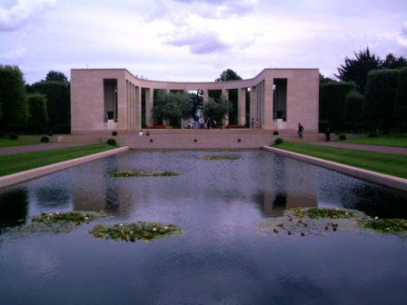
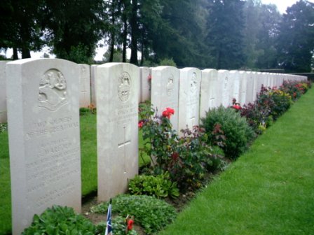
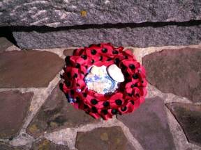
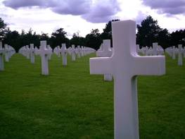 Perhaps the most
important stop on the D-Day tour is the American military cemetery. Apart from
Arlington cemetery in Washington DC, it is probably the second most visited
cemetery of all US cemeteries. Within its walls lie the white cross and Star
of David markers of over 9,000 soldiers. Whereas the British tend to bury
their soldiers where they fall, making for a large number of small cemetery
plots, the US has always gathered their dead into one area, making for very
large military cemeteries. The one in Normandy is no exception. It's
enormous. At one end is a beautiful monument that gives pictorial
representations of the D-Day landing and the continuation of the war to the
defeat of the Germans. In the center is a statue of a young man rising from
flames. The entire monument is set off by a calm reflecting pond. Beyond lay
the neat and orderly rows of markers. Thousands of them. Among the young men
lay 3 Medal of Honor recipients and 4 women. To visit and wander about is truly
an awe inspiring experience. Interestingly, it's not just Americans who visit
either.
Perhaps the most
important stop on the D-Day tour is the American military cemetery. Apart from
Arlington cemetery in Washington DC, it is probably the second most visited
cemetery of all US cemeteries. Within its walls lie the white cross and Star
of David markers of over 9,000 soldiers. Whereas the British tend to bury
their soldiers where they fall, making for a large number of small cemetery
plots, the US has always gathered their dead into one area, making for very
large military cemeteries. The one in Normandy is no exception. It's
enormous. At one end is a beautiful monument that gives pictorial
representations of the D-Day landing and the continuation of the war to the
defeat of the Germans. In the center is a statue of a young man rising from
flames. The entire monument is set off by a calm reflecting pond. Beyond lay
the neat and orderly rows of markers. Thousands of them. Among the young men
lay 3 Medal of Honor recipients and 4 women. To visit and wander about is truly
an awe inspiring experience. Interestingly, it's not just Americans who visit
either.
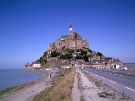
 We had one more
must see place to visit before getting rid of the car. Mt. St. Michel is one
of those places you see pictured on travel posters and brochures time and
again, to the point where it becomes almost an icon for that place. Stuck out
into the Atlantic is this rather rocky, small sometimes island upon which a
fantastic abbey was built. It's unique in that it used to be accessible on
foot only during low tide. Also, the island's so small that it sits isolated
with almost no vestige of 20th century in sight. It does look a bit like a
sand castle sitting out there on the beach.
We had one more
must see place to visit before getting rid of the car. Mt. St. Michel is one
of those places you see pictured on travel posters and brochures time and
again, to the point where it becomes almost an icon for that place. Stuck out
into the Atlantic is this rather rocky, small sometimes island upon which a
fantastic abbey was built. It's unique in that it used to be accessible on
foot only during low tide. Also, the island's so small that it sits isolated
with almost no vestige of 20th century in sight. It does look a bit like a
sand castle sitting out there on the beach.